Vegetation & Habitat Assessment Services in Round Lake, IL
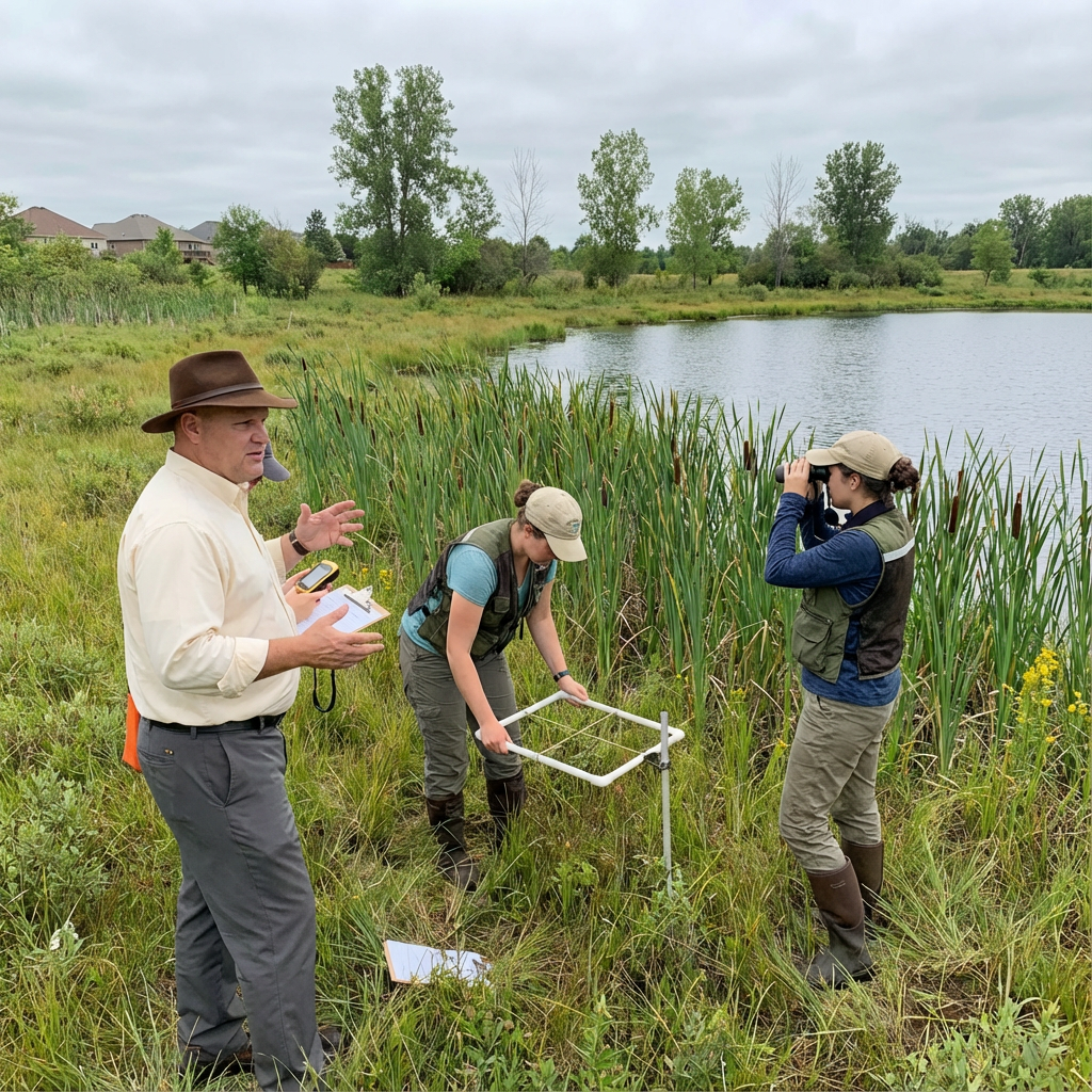
Vegetation and habitat assessment services in Round Lake mean documenting what’s actually growing on your property instead of guessing based on what should be there. Most habitat assessments rely on aerial photos and quick walkthroughs. They miss rare species hiding in degraded areas. They identify invasives as natives. They declare sites worthless when remnant quality plants exist in small patches. Real assessments require walking every acre, identifying every species, and understanding what the plant community indicates about site history and restoration potential.
Understanding Plant Communities and Habitat Quality
Why Species Lists Don’t Tell the Whole Story
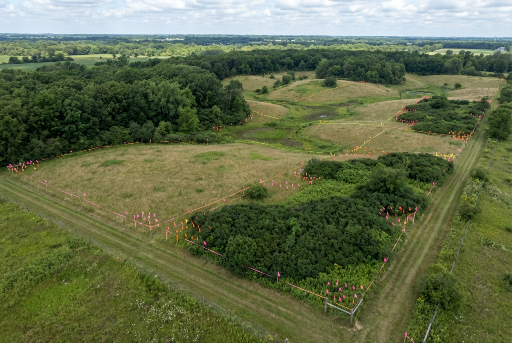
Most habitat assessments deliver a species list and call it done. Found 45 plant species. Three are state-listed. Assessment complete. This tells you almost nothing useful. What matters is which species dominate, which are scattered, and how they’re distributed across the property. Finding one compass plant doesn’t mean you have quality prairie. It might be the last survivor in an acre of smooth brome. Meanwhile the species list misses that your property has 90% invasive coverage because it just counts what’s present, not abundance. We map species distribution showing where quality exists and where degradation dominates. This spatial information determines restoration strategy. Our environmental assessment work documents not just what’s present but what plant communities indicate about site conditions and restoration potential.
Identifying Remnant Quality Versus Degraded Habitat

Not all native plant populations indicate quality habitat. One native species surrounded by invasives is remnant quality at best. True high-quality remnants have diverse native plant communities with correct species for the site conditions. Wet areas dominated by native sedges. Dry areas with little bluestem and side-oats grama. Appropriate species for soil type and moisture. Invasive coverage under 5%. Good assessments distinguish between isolated native survivors and functional native communities. Some properties have small high-quality patches worth protecting surrounded by acres of degradation. Other sites have scattered natives with no remnant quality worth salvaging. This distinction completely changes restoration approach and cost. Protecting existing quality costs less than total reconstruction. We identify where quality exists so restoration plans protect those areas while addressing degraded zones.
Understanding What Invasives Reveal About Site History
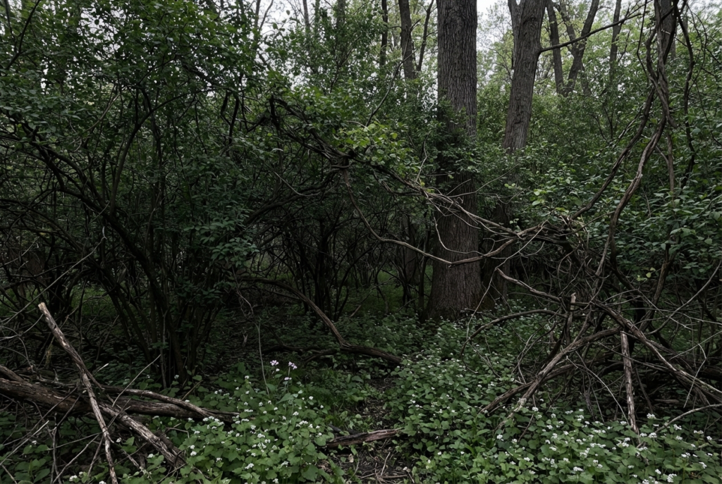
Invasive species tell you what happened to a property. Dense buckthorn means the site was grazed or farmed, then abandoned 30-50 years ago. Reed canary grass indicates disturbed hydrology with seasonal flooding. Autumn olive shows old field succession on dry uplands. Each invasive has specific conditions it exploits. By mapping invasive distribution, we reconstruct site history even without old records. This history matters for restoration. Former agricultural fields need different strategies than degraded remnants. Sites with intact hydrology restore easier than areas with drainage tiles still functioning underground. According to the USDA Natural Resources Conservation Service habitat assessment protocols, understanding site disturbance history is essential for effective restoration planning. Our ecological restoration assessments include site history reconstruction based on vegetation patterns and invasive species distribution.
Documenting Rare Species Requires Correct Timing

State-listed plant surveys fail constantly because timing is wrong. Survey too early and spring ephemerals haven’t emerged yet. Survey too late and they’ve already gone dormant. Each rare species has a narrow window when it’s visible and identifiable. Cream gentian blooms in September. Miss September and you won’t find it even if hundreds of plants exist on site. Shooting star blooms in May. Survey in June and it’s invisible. Good assessments happen multiple times across the growing season. Spring survey for early bloomers. Summer survey for grasses and mid-season flowers. Fall survey for late bloomers and seed head identification. Single-visit surveys miss species that weren’t visible that specific day. We schedule surveys matching target species phenology so we document what’s actually present rather than what happened to be blooming during one random site visit.
Habitat Quality Metrics Beyond Plant Lists
Habitat quality assessment requires measuring more than plant diversity. Vertical structure matters. Does vegetation have ground layer, mid-story, and canopy? Or is everything the same height? Horizontal patchiness matters. Are there different plant communities in different areas or is everything homogeneous? Age structure matters. Are there seedlings and saplings or just old declining stems? Organic matter accumulation matters. Deep leaf litter and woody debris indicate long-term ecological function. These structural metrics determine whether habitat supports wildlife or just exists as plant museum. Two sites with identical species lists can have completely different habitat quality based on structure. We assess structure, age classes, organic matter, and spatial diversity in addition to species presence. Providing vegetation and habitat assessment services in Round Lake means evaluating habitat function, not just listing what grows there.
Translating Assessment Results Into Action
Most habitat assessments end with species lists and quality rankings that don’t tell property managers what to do next. Found high-quality remnant in north corner. Found degraded field in south half. Now what? Good assessments translate findings into management recommendations. Protect high-quality areas from mowing or herbicide drift. Target specific invasives for removal in degraded zones. Identify areas suitable for native planting versus areas needing total reconstruction. Prioritize which areas address first based on quality and threat level. Create spatial management plans showing different strategies for different zones. Our fire management planning can be integrated with habitat assessment results when burning is appropriate restoration tool. Assessment without actionable recommendations wastes money collecting data that never gets used.
Half the Plants Get Misidentified
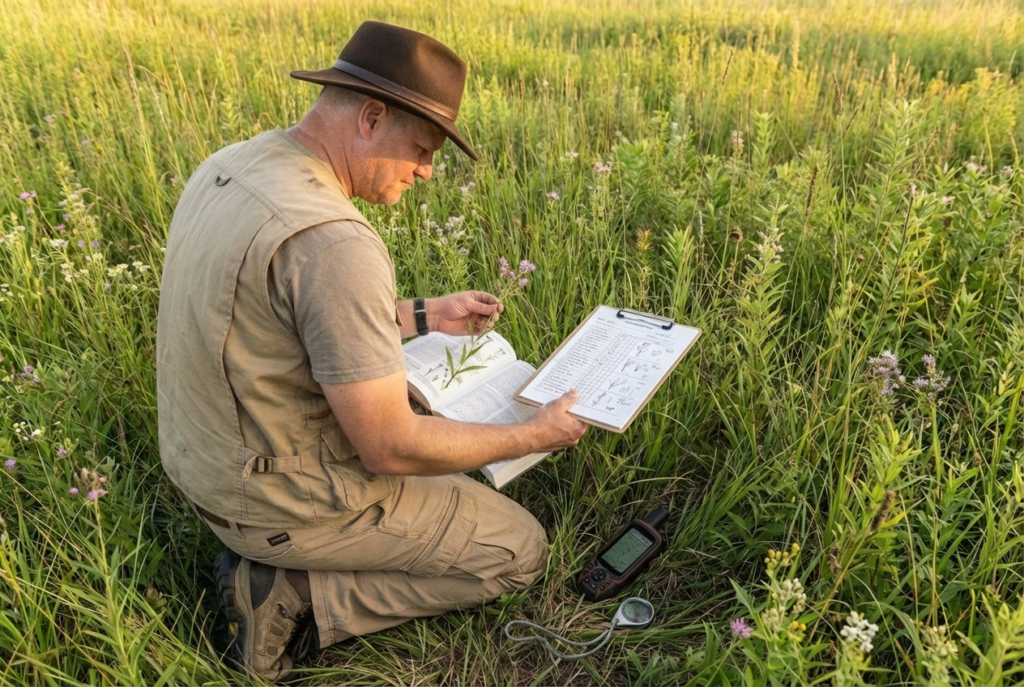
Habitat assessments are only as good as the botanist doing them. We’ve reviewed assessments where consultants identified smooth brome as native grass. Called buckthorn a native shrub. Labeled invasive honeysuckle as a desirable species. These aren’t obscure plants. These are the most common invasives in Lake County. If the consultant can’t identify buckthorn correctly, everything else in the report is suspect. The problem is consultants take contracts for habitat work without actual botanical expertise. They use phone apps or field guides and guess. Wrong identifications lead to wrong management. You protect invasives thinking they’re rare natives. You destroy actual natives thinking they’re weeds. Good assessments require botanists who know plants cold – not consultants learning as they go using identification apps that are wrong 40% of the time.
Assessments Written For Regulators Not Property Managers
Most habitat assessments get written to satisfy regulatory requirements, not to help you manage your property. Report includes coefficient of conservatism scores and floristic quality indices that mean nothing to park district staff trying to decide where to mow. Technical jargon impresses agencies but doesn’t answer basic questions like which areas have value worth protecting and which areas are junk needing total restoration. We’ve seen 40-page reports that never clearly state whether the property is worth restoring or should be written off as too degraded. Assessments need to communicate findings in plain language with clear management implications. Quality rankings matter less than knowing what to do with the information.
Plan Your Habitat Assessment
We can survey your property and deliver assessment results you can actually use to make management decisions.
Call (847) 546-7353 for vegetation and habitat assessment services in Lake County.